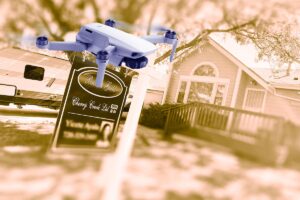
The UAS industry is currently dealing with a serious operational issue tied to FDC 6/4375, creating an airspace restriction that many in aviation have begun referring to as the “ICE NOTAM.”
Issued on January 16, 2026, the NOTAM creates a nationwide flight restriction for drones within 3,000 feet laterally and up to 1,000 feet vertically of any Department of Defense, Department of Energy, or Department of Homeland Security facility and mobile asset. In practice, this includes mobile immigration enforcement operations.

The Compliance Problem
The issue is not the intent of the restriction. Protecting federal personnel and sensitive operations is understandable. The problem is how the restriction is structured.
Many DHS operations, particularly those conducted by Immigration and Customs Enforcement (ICE), are mobile and undisclosed. Convoys and enforcement teams do not broadcast their locations, and no one in the drone industry expects them to. But because the NOTAM creates a roving 3,000-foot protection zone around these mobile assets, drone operators have no practical way of knowing when they might be inside restricted airspace. Or when one of those operations moves into their flight area.
A pilot could be legally a commercial job, or just out having fun while flying recreationally, when a federal convoy enters the area. At that point, the operator may be ensnared inside a restricted zone with no way of knowing it.
Why This Matters
Under FAA’s new enforcement policy updates, violations of airspace restrictions are to be taken very seriously.
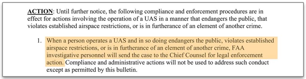
According to FAA Order 2150.3C Change 13, when a drone operator violates established airspace restrictions, FAA investigators are directed to “send the case to the Chief Counsel for legal enforcement action”. Change 13 starts on Page 288 in the above link.
In other words, a pilot who has done everything right, including checking airspace, reviewing NOTAMs, and obtaining LAANC authorization, could still easily face enforcement action for violating a restriction they had no ability to detect ahead of time.
That creates a compliance situation that many operators view as fundamentally unfair.
A Restriction That Can’t Be Checked
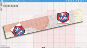
Drone pilots already rely on several tools to avoid restricted airspace:
LAANC authorizations
FAA TFR maps
apps like Air Control
But these tools only work when restrictions are published and visible. A mobile federal operation that is not publicly disclosed cannot be identified during preflight planning. That means operators flying in cities, agricultural areas, construction sites, or infrastructure corridors could unknowingly violate the NOTAM simply because federal personnel moved into the area during their flight.
When a government agency actively withholds the locations of convoys that trigger a Temporary Flight Restriction (TFR), operators have no practical way of determining where those restrictions are active. Without that information, it becomes impossible to know whether a flight may inadvertently enter restricted airspace. This creates a direct conflict with the public’s legal right to access and utilize the navigable airspace of the United States. More concerning, it introduces the very real possibility that a flight which would otherwise be perfectly lawful could unknowingly cross into a TFR tied to national security protections, potentially exposing the operator to severe penalties despite having no reasonable means of avoiding the violation.
For many commercial and recreational operators, that creates significant risk.
A Temporary Workaround
The NOTAM itself states that operators who cannot coordinate with federal points of contact may reach out to the FAA’s System Operations Support Center (SOSC) for assistance.
Pilots can contact the SOSC by email at 9-ATOR-HQ-SOSC@faa.gov and ask whether their planned area of operation could conflict with FDC 6/4375. I strongly suggest you email them so you have a written record, and more importantly, SOSC can relay actual numbers of affected pilots to DHS (assuming they are the hold up with the modified NOTAM language). Tell them in your email that you have checked the area and don’t see any mobile DHS units. Then ask them to let you know if any are incoming into your area.
Realistically, operators are unlikely to receive a waiver or confirmation that their airspace is clear. And SOSC is not going to inform you of any “incoming units” for obvious reason. That’s assuming that they even know. Which is unlikely. However, contacting the SOSC does help document that operators are attempting to comply with the restriction and highlights the operational uncertainty the NOTAM creates.
A Fix May Already Exist
According to several conversations within the industry, the FAA has indicated that a revised version of the NOTAM has already been prepared, but that it is currently being held up by another federal agency. And that agency is widely believed to be the U.S. Department of Homeland Security.
If true, it underscores how important it is for policymakers to understand the real world impact of this restriction.
The Bottom Line
No one in the drone community is arguing against legitimate law enforcement or national security operations. Those missions are important and deserve protection. But aviation safety depends on one basic principle: pilots must have a reasonable way to determine whether the airspace they are entering is restricted.
As written today, FDC 6/4375 does not provide that.
Until this issue is resolved, drone operators across the United States face the possibility of unknowingly violating a national security restriction simply by flying in their own communities. That is not a sustainable situation for an industry that is trying to operate safely, responsibly, and in full compliance with federal regulations.
FAA’s UAS Support Center Guidance
When asked, the FAA’s UAS Support Center has been giving drone operators the following advice (which is appreciated):
- Regardless of operating rule (Part 107, Part 91, or § 44809), all drone operators are required to conduct due diligence prior to taking off. This includes ensuring their UAS is appropriately registered and compliant with Part 89 Remote Identification of Unmanned Aircraft. An essential component of this due diligence is an analysis and determination of the airspace in which you will be flying. Remote pilots/operators should be using multiple, readily available online resources such as the B4UFLY service, UAS Facility Map, and VFR sectional charts.
- At any time during an operation, if the remote pilot/operator has reason to believe any operation as described in FDC 6/4375 is staging or occurring, and their UAS operation may be within the distances provided in the NOTAM, then the remote pilot/operator should land the drone until they can ensure compliance with the NOTAMS requirements.
- At any time during an operation, if the remote pilot/operator is approached by a federal agent and advised they are operating within a TFR, then the remote pilot/operator should cease operation.
So we do have that official guidance. However, “FAA Guidance” does not override an FAA/DHS published TFR. This needs to be fixed NOW! And a little bit of “polite persistence” could be the key to getting that “fix” implemented.